Su Tong Pae Bridge Along the Mae Hong Son Loop
A scenic and cultural perspective for travelers tracing Mae Hong Son Province from Chiang Mai
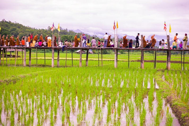
A journey through Mae Hong Son Province is shaped as much by quiet rural landscapes as by famous viewpoints. Su Tong Pae Bridge belongs to that quieter side of the region: a bamboo walkway crossing open fields and linking a local community with a Buddhist monastery area. Its appeal comes from the relationship between the bridge, the rice-growing landscape, and the people who maintain this distinctive passage. For travelers planning a Mae Hong Son Loop Tour From Chiang Mai, the bridge offers more than a brief photo stop. It provides a chance to slow down and notice how village life, seasonal farming, religious spaces, and mountain scenery meet in one setting. The experience is most rewarding when visitors arrive with patience and cultural awareness rather than treating the bridge as a backdrop alone. This perspective places Su Tong Pae within the wider regional flow of the loop. It considers what the bridge represents, how it can fit into a longer overland journey, and why nearby cultural and natural stops such as Phu Klon and Ban Huay Pu Keng broaden an understanding of Mae Hong Son.
A Bamboo Bridge Rooted in Mae Hong Son Province
Su Tong Pae Bridge is associated with the countryside of Mueang Mae Hong Son District, where mountain slopes, cultivated land, and small settlements create a distinctly rural setting. The bridge is commonly described as a community-built bamboo walkway extending across fields toward the Suan Tham Phusama monastery area. That practical connection is central to its character. It is not simply an isolated structure placed in nature; it reflects cooperation between local residents and a religious community.
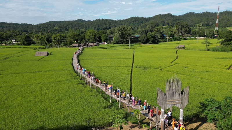
The Sutongpae Bamboo Bridge’s appearance changes with the agricultural season. Green fields can create a fresh, expansive view during periods of active growth, while drier months may reveal a more muted palette and clearer patterns in the surrounding land. Weather also affects the atmosphere, with mist, cloud, and strong mountain light giving the same walkway different visual qualities. These changes are part of the attraction, so expectations are best based on observing the landscape rather than seeking one guaranteed view.
The cultural importance of Su Tong Pae is modest and local in scale, which is precisely why respectful attention matters. Visitors share the area with residents, farmers, and worshippers. Walking quietly, remaining on the designated path, avoiding damage to bamboo or crops, and dressing appropriately near religious spaces help preserve the setting for the community as well as for future visitors.
Where the Bridge Fits on a Chiang Mai Loop
The Mae Hong Son Loop is a regional road journey rather than one single attraction route. From Chiang Mai, travelers may pass through changing landscapes that include forested mountain roads, valley settlements, Pai, and Mae Hong Son town before continuing around the province or returning by another route. The experience depends on the pace of the journey, road conditions, and the number of cultural or natural stops included along the way.
A Mae Hong Son Loop Tour From Chiang Mai can incorporate Su Tong Pae as a scenic pause during time spent around Mae Hong Son town. Its value within the loop is that it contrasts with long stretches of winding road. After viewing broad mountain scenery from a vehicle, travelers can walk at ground level through farmland and notice smaller details: woven bamboo construction, field edges, monastery architecture, and the sound of rural life.
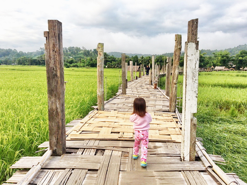
Because the loop covers a large and mountainous area, the bridge should be considered one regional stop rather than the basis for a rushed itinerary. Allowing time for weather changes, rest, and unplanned viewpoints makes the journey more comfortable. Travelers should also confirm current road and local access conditions through reliable sources, since rural routes and attractions can be affected by seasonal weather or community activities.
The best loop journeys connect places by theme as well as geography. Su Tong Pae can represent community cooperation and cultivated landscapes; other stops may highlight hot springs, forests, hill reservoirs, historic settlements, or diverse local traditions. This broader approach keeps the bridge from being reduced to a single photograph and encourages a more thoughtful understanding of northern Thailand.
What to Notice During a Visit
The first impression is often visual: a narrow bamboo walkway extending across an open field toward the tree line and monastery grounds. Yet the more interesting details appear when the pace becomes slower. Look at how the bridge sits slightly above the cultivated land, how bamboo components are joined, and how the surrounding fields frame the distant hills. The scene demonstrates how a simple structure can become a meaningful part of a landscape without dominating it.
The bridge is also a useful place to think about the relationship between religious institutions and neighboring communities. Access to a monastery area may be part of the reason the walkway was built and maintained, while nearby residents benefit from a practical route and visitors bring attention to the area. That relationship should not be interpreted as a performance arranged solely for tourism. It is better understood through observation and respectful conduct.
Photography can be enjoyable, especially when morning or late-afternoon light emphasizes the texture of the bamboo and the contours of the fields. However, photographs should not intrude on worship, work, or private life. Ask before photographing people, avoid entering planted areas for a better angle, and keep voices low around religious buildings. These small decisions allow the scenery and the community to remain comfortable together.
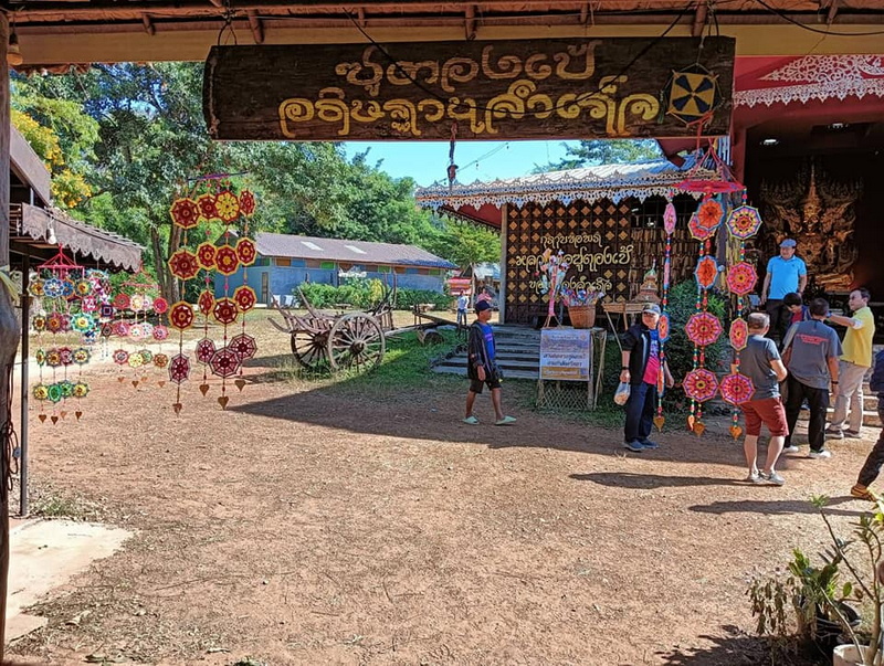
A visit can also be affected by rain, heat, and the condition of the bamboo surface. Sensible footwear is useful, and travelers should take care on uneven or damp sections. The bridge is best approached as a rural walking experience rather than an amusement structure. Its charm lies in simplicity, seasonal change, and the surrounding sense of place.
Making the Scenic Stop Meaningful
For a culture-focused traveler, Su Tong Pae offers a valuable reminder that regional tourism is built from ordinary places as well as headline attractions. The walkway connects a visitor to a working landscape, but it does not give visitors ownership of that landscape. A responsible visit means observing boundaries, supporting local community practices where appropriate, and accepting that not every part of village life is available for viewing or photographing.
Travelers can help reduce pressure by avoiding litter, carrying reusable water containers where practical, and following any local guidance about access. If there are community stalls or locally made products in the area, fair and polite purchasing can be one way to contribute, though buying should never be treated as an obligation. More broadly, respectful behavior and patience often matter as much as spending.
The bridge works particularly well in a loop narrative because it links scenery with human geography. Mountain roads explain the province’s isolation and beauty, while the fields and monastery area show how people create connections within that environment. Seen this way, Su Tong Pae is not a detour from the Mae Hong Son story. It is a small expression of the region’s adaptability, craftsmanship, and community life.
Extending the Loop Beyond the Bridge
Once the bridge has introduced the agricultural and spiritual character of the area, the wider loop can continue through places that reveal different sides of the province. Two contrasting stops are especially useful for connecting natural features with community culture.
Phu Klon
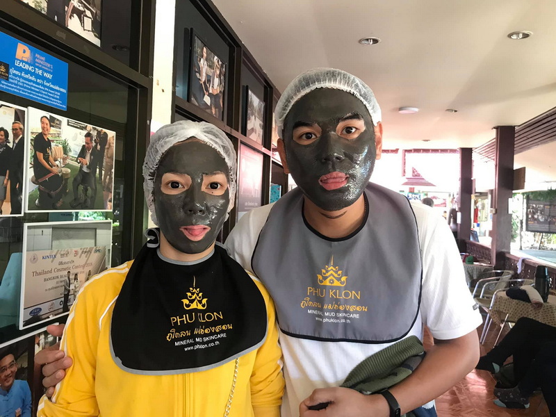
Phu Klon adds a natural and wellness-oriented dimension to the Mae Hong Son route. The site is known for mineral mud and geothermal features, giving travelers a different way to experience the province’s underlying geology. Its appeal contrasts with the open agricultural setting of Su Tong Pae: one place emphasizes a cultivated cultural landscape, while the other draws attention to heat, minerals, and natural processes.
As part of a wider journey, Phu Klon can help vary the rhythm of sightseeing. Visitors should follow current site guidance, use designated areas, and treat any wellness activity as optional rather than a guaranteed health treatment. The main value is the opportunity to encounter another facet of Mae Hong Son’s natural environment.
Ban Huay Pu Keng
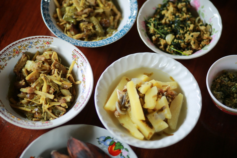
Ban Huay Pu Keng is a community on the Pai River associated with Karen cultural heritage and river-based local life. A visit can broaden the cultural perspective established at Su Tong Pae by showing how a community’s identity is connected to landscape, traditions, and everyday livelihoods. Travelers should approach with humility and avoid treating residents or cultural practices as spectacles.
Community visits are most considerate when visitors follow local guidance, ask permission before taking photographs, and remain open to learning rather than expecting a staged experience. The village is best included as a place for respectful cultural exchange, with time given to listening and observing. Together with the bridge, it helps reveal the human variety and environmental diversity found across Mae Hong Son Province.
A Smaller View of a Larger Journey
Su Tong Pae Bridge earns its place on a Mae Hong Son journey through balance rather than spectacle. Bamboo, fields, monastery grounds, and mountain weather come together in a setting that rewards quiet observation. When combined thoughtfully with places such as Phu Klon and Ban Huay Pu Keng, the bridge becomes part of a richer regional story about landscape, belief, community, and travel. Visitors who walk carefully, respect local boundaries, and allow the scene to unfold at its own pace will gain more than a photograph: they will notice how the Mae Hong Son Loop is held together by many small, meaningful connections.


