Kho Ku So Bamboo Bridge and the Mae Hong Son Loop
A practical regional guide to Pai, loop routes, and land-based travel from Chiang Mai
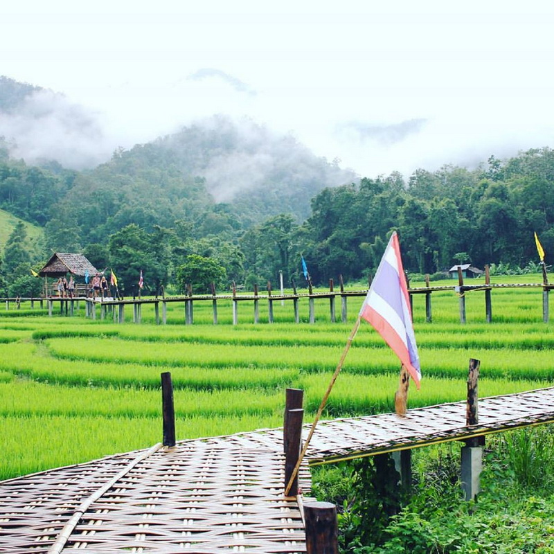
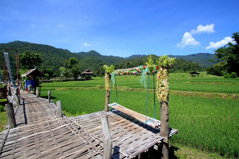
Kho Ku So Bamboo Bridge is a scenic walkway in Pai District, Mae Hong Son, where a simple bamboo route leads through the countryside and cultivated landscapes. Often referred to as the Pai Bamboo Bridge, it is best understood as one stop within a wider northern Thailand journey rather than an isolated attraction. Its rural setting gives visitors a slower contrast to Pai’s busier town center and makes it a useful point on a regional itinerary. For travelers arriving from Chiang Mai, the bridge also provides a practical reason to think beyond a single transfer. A carefully planned Mae Hong Son route can connect Pai with mountain roads, local communities, waterfalls, viewpoints, and Mae Hong Son town. This guide focuses on how the bridge fits into that larger journey, what different loop-tour formats involve, and how Land Tours in Chiang Mai can help organize overland travel without promising fixed schedules or identical inclusions. The aim is straightforward: to help first-time international visitors choose a sensible travel pattern, allow enough time for the landscape, and combine the bridge with nearby places that complement its rural character.
Understanding the bridge within Pai’s countryside
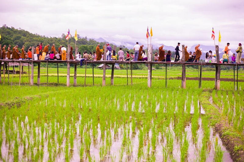
Kho Ku So Bamboo Bridge is located in Pai District, Mae Hong Son, an area known for winding mountain roads, valleys, agricultural land, and small settlements. The walkway itself is a low-key cultural and nature stop rather than a large built attraction. Visitors generally come for the views, the quiet walking experience, and the chance to observe how a rural route can connect cultivated areas with local places of worship and community life.
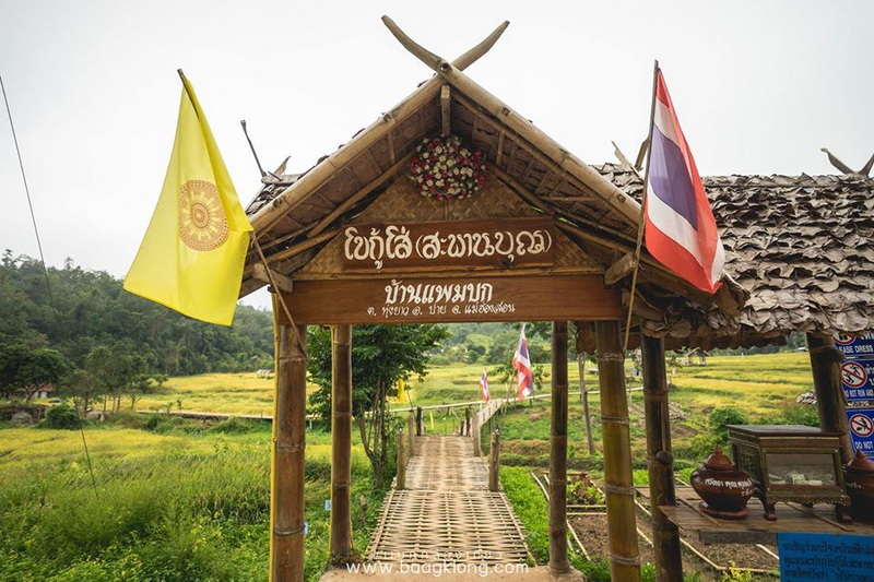
The name appears in several English spellings, including Kho Khu So Bridge and Kho Khu So Bamboo Bridge. These variations can be useful when comparing maps or discussing an itinerary, but they refer to the same Pai-area destination. The setting is especially appealing in the morning or late afternoon, when softer light can make the surrounding fields and hills more expressive. Conditions may change with weather and seasonal maintenance, so sensible footwear and a flexible attitude are worthwhile.
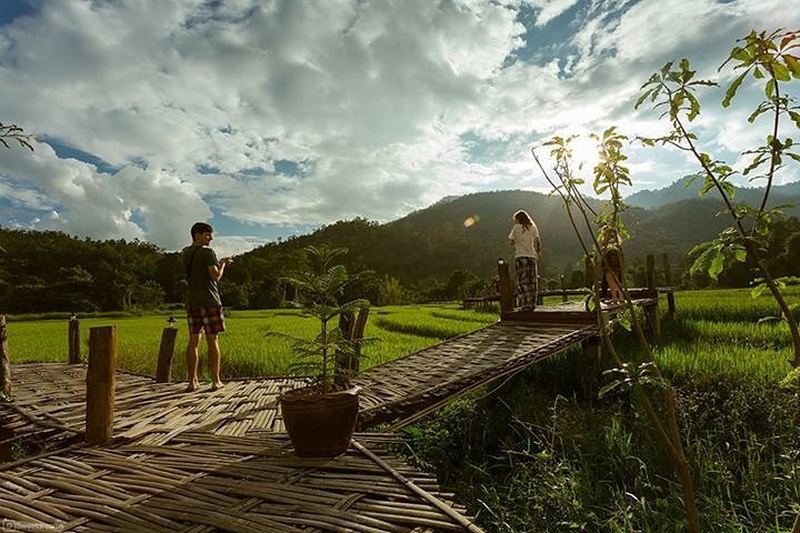
A visit does not need to be rushed. Allowing time to walk carefully, pause for photographs without obstructing others, and appreciate the landscape gives the stop more meaning than treating it as a quick checklist item. Respect for local residents, religious spaces, agricultural areas, and any access guidance is important. The bridge is part of a lived environment, not simply a photo backdrop.
How a Mae Hong Son loop tour can include Pai
A Mae Hong Son Loop Tour From Chiang Mai usually refers to a multi-day overland journey through northern mountain districts, with Pai commonly serving as one of the major stops. The exact direction varies. Some itineraries travel first toward Pai and continue west toward Mae Hong Son, while others take a different sequence before returning to Chiang Mai. The choice depends on road conditions, available time, traveler preferences, and the operator’s current routing.
A shorter loop may concentrate on Chiang Mai, Pai, and selected countryside stops, giving travelers an introduction to the region without attempting every destination. A longer version can continue toward Mae Hong Son town and include additional viewpoints, villages, caves, waterfalls, or cultural sites along the route. These formats are not interchangeable: the longer journey offers more regional context, while the shorter plan may suit visitors with limited holiday time.
When reviewing a loop tour, ask how much time is actually spent in Pai and whether Kho Ku So Bamboo Bridge is included as a planned stop or is visited only when conditions allow. It is also useful to clarify the transport style, overnight locations, road-time expectations, meal arrangements, and whether entrance fees are separate. Avoid choosing solely by the number of named attractions. A route with realistic driving periods and unhurried stops can be more enjoyable than an overloaded itinerary.
Mountain travel can be tiring for visitors who are sensitive to winding roads. Travelers who experience motion discomfort may prefer a vehicle with appropriate seating, regular breaks, and a route that does not attempt to cover excessive distances in one day. Those considerations are particularly relevant when combining Chiang Mai, Pai, and Mae Hong Son in one continuous journey.
Choosing land-based travel from Chiang Mai
Land Tours in Chiang Mai provide an alternative to arranging every road transfer independently. In this context, land travel can include private vehicles, shared vans, guided overland routes, or custom multi-day journeys. The most suitable format depends on group size, comfort preferences, language needs, and how much control travelers want over stop duration. A land-based arrangement is particularly useful for visitors who want to connect several districts rather than remain in one city.
For a bridge-focused itinerary, travelers can ask whether the route allows sufficient time around Pai instead of treating the town as a brief overnight transfer. A balanced plan might place the bamboo bridge alongside countryside scenery and a town visit, then continue on a later day toward Mae Hong Son or return toward Chiang Mai. This approach keeps the attraction connected to the regional story while avoiding an unnecessarily crowded schedule.
Independent travelers should compare practical details before confirming any arrangement. Important questions include the type of vehicle, luggage capacity, driver or guide responsibilities, hotel pickup area, road-time estimates, cancellation terms, and how weather-related changes are handled. These details are more useful than broad claims about being the fastest or most complete option. Availability can vary, so checking current information directly with a reputable local provider is sensible.
A locally arranged land journey may also support more thoughtful pacing. Drivers and guides familiar with the route can explain where breaks are practical and identify suitable points for meals or photographs, although the exact experience depends on the booking. Travelers should still communicate clearly about mobility needs, dietary requirements, preferred walking levels, and any interest in cultural sites. Good planning creates confidence without removing the flexibility that makes an overland journey rewarding.
Building a comfortable regional itinerary
The distance from Chiang Mai to Pai and onward through Mae Hong Son makes this a route for travelers who can spare several days. Trying to visit the bridge, Pai, and distant Mae Hong Son locations in a single day would leave little time for walking or observation. A multi-day plan is more appropriate, particularly for first-time visitors who want to experience the changing landscape rather than simply pass through it.
Season and weather influence the character of the countryside. Dry periods may offer clearer walking conditions, while rainy weather can make bamboo surfaces and rural paths slippery. Visitors should carry water, sun protection, light rain gear, and shoes with dependable grip. Modest clothing is appropriate when an itinerary includes religious or community spaces, and visitors should ask before photographing people, ceremonies, or private areas.
The best route also depends on the purpose of the trip. A landscape-focused traveler may prioritize walking time and viewpoints. Someone interested in local life may prefer a guide who can explain farming patterns, settlement history, and respectful visitor behavior. Travelers seeking rest may reduce the number of daily stops and spend longer in Pai. There is no single correct loop; the important point is matching the route to energy levels and available time.
Before departure, confirm current access conditions, road status, accommodation locations, and any seasonal changes with local sources. Maps can show approximate distances but do not always communicate the time required on mountain roads. Keeping one flexible period in the itinerary allows the journey to adapt to weather or fatigue while preserving the central experience of Pai’s countryside.
Two Complementary Stops Around Pai
Once the main route has been planned, a pair of nearby experiences can broaden the day without changing its regional focus. One brings visitors back into Pai’s social center, while the other returns attention to the surrounding natural landscape.
Pai Walking Street
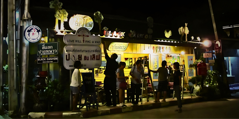
Pai Walking Street offers a contrasting evening experience after the quiet rural setting of the bridge. The central pedestrian area is associated with food stalls, small shops, handmade products, and casual places to sit. Its atmosphere changes through the evening, so visitors can browse at an unhurried pace rather than treating it as a formal sightseeing site.
Pairing the two places creates a useful day-to-night rhythm: countryside walking during daylight and a livelier town environment later. Travelers should remain aware of local residents and other visitors, keep personal belongings secure in crowded areas, and make purchasing decisions respectfully. The walking street is most valuable as a glimpse of Pai’s visitor economy and social center, not as a replacement for experiencing the surrounding district.
Pam Bok Waterfall
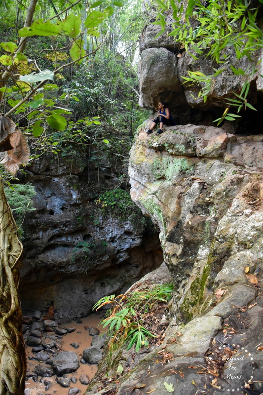
Pam Bok Waterfall adds a natural feature to an itinerary centered on the bamboo bridge. Set within a narrow landscape near Pai, the waterfall is associated with rock formations, greenery, and seasonal water conditions. Its appearance and accessibility can vary, particularly after heavy rain, so travelers should follow local guidance and avoid slippery edges or unsafe water levels.
The waterfall works well as part of a countryside circuit when driving time and walking conditions are considered realistically. It gives the day a different texture from the bridge: one stop emphasizes a human-made rural walkway, while the other highlights a natural setting shaped by terrain and water. Combining them can be rewarding, provided the schedule leaves room for careful movement and changing weather.
Making the Bridge Part of a Wider Journey
Kho Ku So Bamboo Bridge is most rewarding when included in a well-paced Pai and Mae Hong Son itinerary rather than treated as a hurried photo stop. Loop tours from Chiang Mai can provide regional structure, while land-based arrangements offer practical help with mountain transport and connections between destinations. By checking current conditions, allowing realistic travel time, and combining the bridge with Pai Walking Street and Pam Bok Waterfall, visitors can experience both the human and natural character of the area with greater confidence.