Land Split Pai and the Regional Routes of Mae Hong Son Province
A practical regional perspective on loop travel, land tours, and Pai’s surrounding landscape
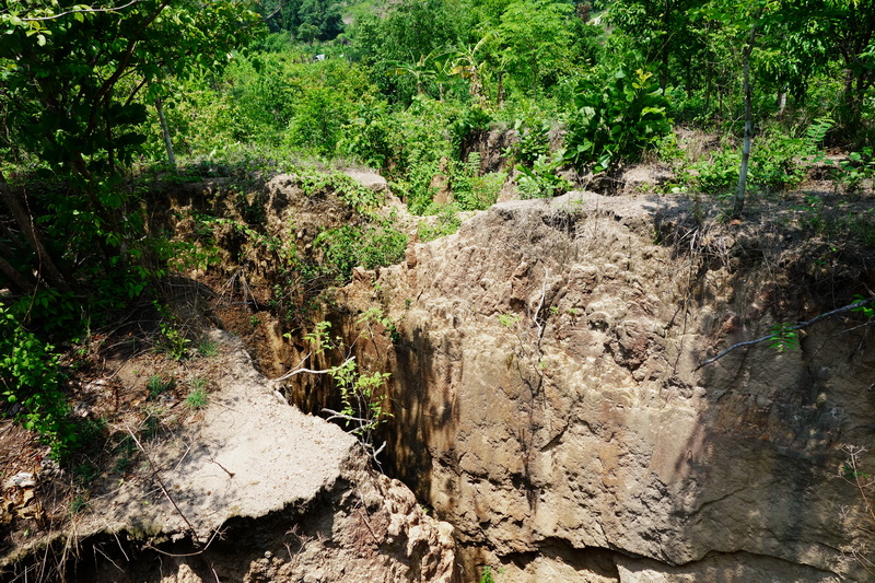
Land Split Pai is more than a short stop beside a rural road. It is a small geological and agricultural site that fits naturally into a wider journey through Mae Hong Son Province, where distances, winding routes, and changing landscapes shape the travel experience. The attraction is known for a large crack in the ground that appeared on farmland, creating an unusual place for visitors to observe how a local family has adapted its property into a welcoming stop. For independent travelers, the greater value of the site lies in its regional position. Pai can be treated as one point on a broader northern Thailand route rather than an isolated destination. A visit may be combined with rural viewpoints, waterfalls, cultural areas, and market time, provided the day is planned around realistic road distances rather than an overloaded checklist. This guide considers Land Split Pai through that regional lens. It explains how loop tours from Chiang Mai work conceptually, how land-based tour planning can connect Pai with the rest of the province, and why nearby places such as Pai Walking Street and Kho Ku So Bamboo Bridge can complement a visit without turning the journey into a rushed sequence of stops.
Reading Land Split within Mae Hong Son Province
Mae Hong Son Province is defined by mountain terrain, dispersed settlements, and roads that often require more time than a map may suggest. Pai sits in the eastern part of the province and functions as a popular base for exploring nearby rural scenery. Land Split is therefore best understood as part of a landscape rather than as a stand-alone monument. Its setting among cultivated land gives the visit a direct connection to local farming and to the everyday geography surrounding Pai.
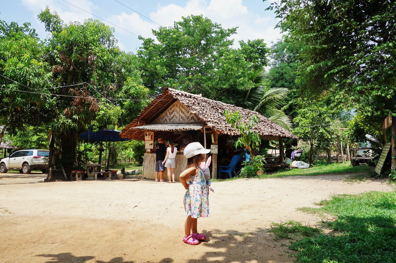
The attraction itself is associated with a naturally formed fissure in the ground. Visitors generally come to look at the split, walk through the surrounding farm area, and learn about the site from the family managing it. The experience is modest in scale, which is part of its character. It does not require the same amount of time as a major national park or historic complex, but it can offer a useful pause between larger destinations.
A respectful visit should recognize that this is also a working private property. Travelers should follow signs, stay within areas open to visitors, avoid entering cultivated sections without permission, and treat any offered refreshments or donation arrangements as part of the local hosting model rather than an entitlement. Asking before taking photographs of people, homes, or private activities is a simple way to keep the encounter considerate.
How Loop Tours from Chiang Mai Build a Regional Journey
A Mae Hong Son Loop Tour From Chiang Mai is not one single fixed itinerary. The term usually describes a multi-day circuit through northern mountain roads, with Pai, Mae Hong Son town, and other provincial areas connected according to the chosen direction and available time. Some travelers focus on the eastern approach through Pai, while others plan a longer circuit that continues toward the provincial capital and the southern part of the province.
The important planning issue is rhythm. Roads through the mountains can be scenic but slow, and frequent bends make comfort and concentration more important than covering the maximum number of places. A regional loop works best when travelers allow time for viewpoints, meals, weather changes, and unplanned pauses. Trying to treat every location as a brief photograph stop may technically increase the number of places visited, but it reduces the quality of the journey and can create unnecessary pressure.
Land Split can fit into the Pai portion of such a route because it provides a compact rural experience between larger activities. It may suit a morning or afternoon when the priority is to understand the area’s countryside rather than fill the schedule with headline attractions. Travelers continuing toward other parts of the province should check road conditions and local advice before setting out, especially during periods of heavy rain or reduced visibility.
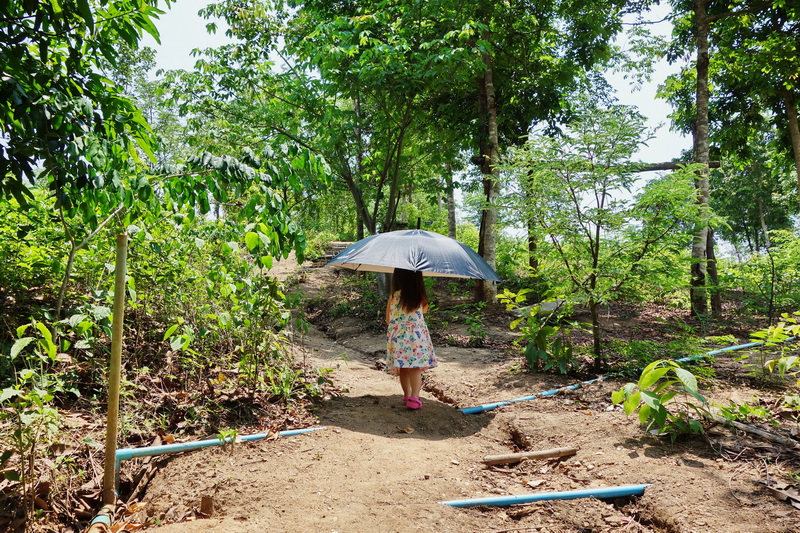
The loop concept also encourages travelers to distinguish between a transport route and a travel experience. Moving from Chiang Mai toward Pai and onward through Mae Hong Son involves changes in scenery, settlement patterns, and daily pace. The value is not only in reaching the next town. It is in observing how mountain communities, farms, forested slopes, and roadside businesses fit together across the region.
Where Land Tours in Chiang Mai Fit into the Plan
Land Tours in Chiang Mai can provide a useful planning framework for visitors who want to travel beyond the city without designing every regional connection alone. A local agency or experienced operator may help compare a private journey, a small group arrangement, or a driver-supported route according to the traveler’s time, interests, and comfort with mountain roads. The most useful role is coordination and local knowledge, not simply adding as many attractions as possible.
When discussing a proposed route, travelers should explain whether the priority is geological interest, rural scenery, photography, cultural learning, relaxed pacing, or a broader provincial circuit. This makes it easier to judge whether Land Split belongs in the plan. The site may be a strong addition for someone interested in landscape and local agriculture, while a traveler with only a few hours in Pai may prefer to keep the schedule closer to town.
It is sensible to ask practical questions before confirming any land-based journey. These can include how much time is expected on the road, whether the route is flexible, how many stops are planned, and whether the visit involves private land or community-managed spaces. Travelers should also clarify what is included in general terms rather than assuming that every suggested stop, meal, or activity is automatically part of a tour.
Responsible tour planning means avoiding promises that cannot be guaranteed. Weather, road conditions, seasonal closures, and local circumstances can affect a route. A good plan leaves room for adjustment and treats the people and places visited as more important than maintaining an inflexible schedule. This approach is particularly appropriate for rural attractions where the visitor experience depends on cooperation with local landholders.
Making the Visit Meaningful Rather Than Merely Brief
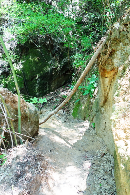
A Land Split Travel Guide should explain not only what to see but also how to look at the site. The most obvious feature is the split in the earth, yet the surrounding farm setting adds context. Notice the contrast between the geological change and the cultivated landscape around it. The visit can prompt broader questions about how residents adapt land use, welcome guests, and share a place that began as an unexpected disruption.
Timing should be considered in relation to the entire day. If Land Split is included with several other destinations, group stops by area where possible and avoid assuming that short visits eliminate road time. A simple sequence with breathing space is usually more comfortable than a long list of attractions spread across the district. Travelers on a self-directed route should use current local information for road access and opening conditions rather than relying only on old online descriptions.
The site also rewards a low-impact approach. Keep noise moderate, carry away rubbish, avoid climbing on fragile edges, and do not remove soil, plants, or stones as souvenirs. If refreshments or locally grown produce are available, purchasing respectfully can support the hosting family, but visitors should not treat a rural home as a commercial attraction with unlimited services. Courtesy is especially important when visiting places where tourism and ordinary life overlap.
For photographers, the strongest record may include the wider setting instead of only a close image of the fissure. Fields, paths, vegetation, and surrounding hills help explain why this place belongs in a regional itinerary. For other travelers, the value may be a short conversation, a quiet pause, or a better understanding of how a local family has interpreted an unusual feature on its land.
Two Complementary Stops around Pai
Once the geological and route-planning context is clear, the surrounding area adds two different dimensions to the visit. One place shows Pai’s lively town center, while the other returns the journey to fields, paths, and rural community spaces.
Pai Walking Street
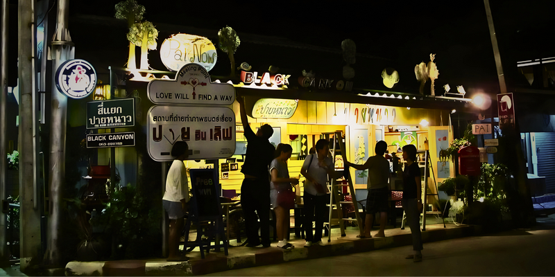
Pai Walking Street provides a useful contrast to the rural character of Land Split. The evening market area is associated with food stalls, drinks, handmade goods, and a concentration of visitors moving through the town center. It can serve as a place to experience Pai’s social and commercial rhythm after spending time among farmland and mountain roads.
The market should be approached as a public community space rather than a staged performance. Travelers can browse without blocking narrow passages, ask before photographing vendors or products, and make thoughtful purchases instead of treating local crafts as disposable souvenirs. Pairing the two places gives the day a clear progression from countryside observation to town life, while still leaving room for a slower pace.
Kho Ku So Bamboo Bridge
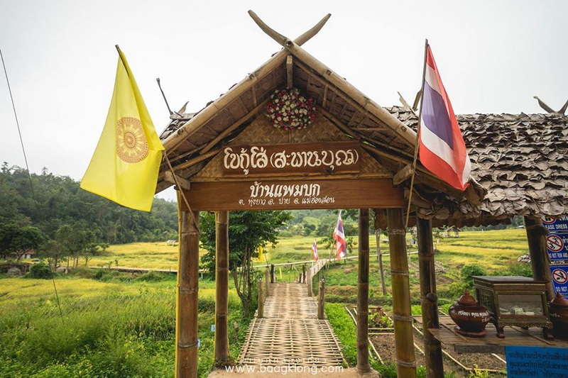
Kho Ku So Bamboo Bridge extends the regional story into a landscape shaped by agriculture, walking paths, and community access. Its elevated bamboo route is known for crossing rural fields toward a temple area, creating a perspective that differs from the geological feature at Land Split. The appeal comes from the relationship between the path, cultivated land, and surrounding hills rather than from speed or spectacle.
Visitors should walk carefully, follow local guidance, and remember that the surrounding fields are part of working agricultural land. Avoiding damage to crops and keeping the route clean helps protect the setting for residents and future guests. As a companion to Land Split in Pai, the bridge broadens the day from one unusual landform to a more complete view of how people, farming, religious spaces, and tourism share the Pai countryside.
Choosing the Right Pace for the Pai Region
Land Split Pai works best when included in a thoughtful regional plan rather than treated as a compulsory box to tick. Its geological feature, agricultural setting, and local hosting connect naturally with the wider character of Mae Hong Son Province. Whether the journey is self-organized or shaped with help from a Chiang Mai operator, the strongest approach is to allow realistic road time, respect private and working spaces, and leave room for observation. Combined with Pai Walking Street and Kho Ku So Bamboo Bridge, the visit can become part of a balanced route that links landscape, community life, and the slower movement of a northern Thailand road journey.


No comments:
Post a Comment